Cultural Identities: Amsterdam (The Netherlands)
City on the IJ
Harry van Veenendaal
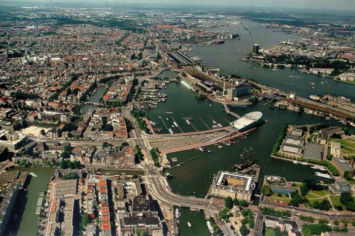
Since the 1980's, Amsterdam has been revitalizing the banks of the river IJ. Where for many years quays and port warehouses have stood empty, tens of thousands of people now live and work.
With the City Council functioning as 'director', the successful development of the Oostelijk Havengebied (eastern harbour district) is now being continued in phases in a westerly direction. In 2012 or thereabouts, the whole of the southern bank of the IJ will have been redeveloped. With these developments, Amsterdam's city centre will be provided with more than ample opportunities for regenerated urban life.
Context
The city centre of Amsterdam, with its famous 'canal belt', is characterized by a mix of activities. It has the allure of a metropolis, hand in hand with small-scale businesses. For many centuries the town planning structure has provided space for renewal. The city centre is pre-eminently the place where people meet each other. Small traditional businesses and IT companies, cafés and restaurants, arts and crafts studios, old and new media, the university, the advertising business, banks and museums, shops and theatres it is that mix that has made the centre of Amsterdam the breeding ground for change.
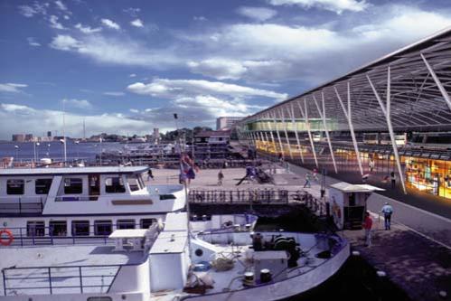
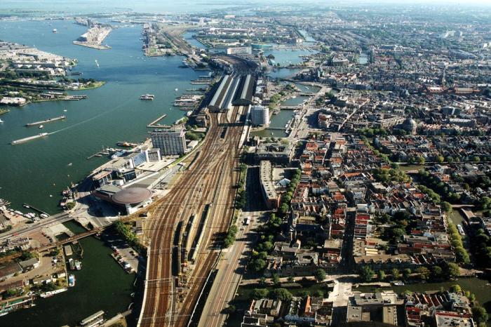
But in the city centre there is no room for every new initiative and expansion; large scale expansion and developing functions must look elsewhere for space. On the banks of the IJ there is still sufficient room. Furthermore, this area is an outstanding point of convergence for traffic and transport facilities. Trains, metros, trams, buses and shipping meet here. There is a direct connection with Schiphol airport, and cruise ships from the whole world dock here. The new north/south metro line and the east-west IJ tram line traverse the district.
The banks of the IJ ensure that Amsterdam's city centre can continue its process of renewal. The area is acquiring a compact and intensive use of space that is exceptional in the Netherlands with a mix of functions similar to the city centre. The city authorities are providing space for community amenities such as the public library, the science museum, the centre for modern music, and a conservatory, together with a passenger terminal and other maritime facilities. Important components of this strategy are the integration of currently valuable buildings, existing functions and users and the stimulation of temporary initiatives. Development contracts have now been awarded for the whole of the area encompassed by this initiative. The renewal taking place on the banks of the IJ can be compared to the development of the Amsterdam Zuidas ( southern axis). There in the area between Schiphol, Amsterdam Zuid and Zuidoost a dynamic district is developing containing both housing and offices, together with businesses oriented on the city centre, the airport and on the Randstad conurbation.
Cultural identities
Amsterdam was founded in about 1200, when a dam was built in the river Amstel which flowed into the IJ. In this way, an inland harbour was created where, at the Dam, goods were transferred to inland shipping. Right up to the present day, Amsterdam can be characterized as a city of commerce and transport, not only because of the port and Schiphol airport, but of course also due to its role as a centre in the field of IT.
There are three further additional constants in the spatial development of Amsterdam:
• the multiracial population, comprising a wide range of nationalities;
• the reclamation of land from the water; and
• the intensive use of space.
The city is traditionally a place of sanctuary for newcomers: years ago these were Chinese and Jews, Huguenots and other refugees, now there are people from Turkey, Morocco and Surinam. Amsterdam is the melting pot for a multiplicity of cultures and ideas. Generally, these newcomers were badly needed for the growing economy.
Time and again after the construction of the dam in the river Amstel, areas covered by water have been turned into land. Islands were created for shipbuilding, trade and industry. The 18th century heralded the need for increasingly larger and deeper canals and harbours. In the 19th century, industrialization brought with it large scale interventions such as the construction of a large number of railways, the Central Station, and the Noordzeekanaal (a shipping route to the North Sea, which involved the construction of a breach through the dunes!). The Oostelijk Havengebied and the banks of the IJ came into being as harbour islands, the structure of which is based on functional requirements such as long, deep quays and yards. Current increases in scale and the growth of container transport are shifting the port function in the direction of the sea. As the result of this, space is being created that can be utilized in the restoration of the original strong and multifaceted relationship between the city and the IJ.
A fourth characteristic of the spatial development of Amsterdam is the intensive use of space. Even centuries ago, the city could not allow itself the luxury of extensive land use. The scarcity of space meant that the land had to be used intensively, with high building densities and the multipurpose use of land.
The revitalization of the banks of the IJ therefore fits in with a centuries-old tradition: the port districts are being allocated new functions, with intensive development; an area with a multiplicity of functions, residents and visitors. The high density of development and the high degree of mixing of a wide variety of functions mean that a dynamic environment with an urban character can be brought into being.
Challenges and programme
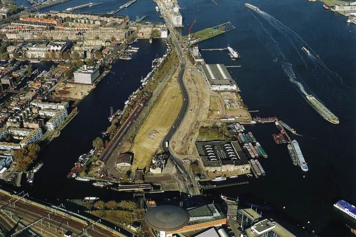
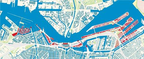
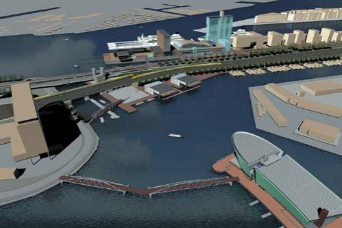
Just as is the case with the Oostelijk Havengebied, the central part of the southern bank of the IJ is being developed, one island after another. The results can already be seen in some areas, such as the Oostelijke Handelskade and in the Oosterdok, and in others the land is still under preparation for development. Each island is being given its own 'colour', a specific construction programme and a specific style. Linking factors are the water, the pattern of the islands, harbours and quays, and the public space as the continuous 'floor' of the city. The layout of public space must ensure cohesion within the area. The plan for public space provides an outline framework for the structure, layout and materialization of the entire IJ river bank area. Together with the pivotal projects, the connection to the city centre and the links to the IJ are thus ensured.
The development of each of the islands is 'tailor-made'. The city authorities take the initiative for the programming and planning for every island. As a result of the leasehold system in Amsterdam in many instances the city is the landowner. In other cases, land is purchased from its owners, or plans are developed in collaboration with the owners. Since the city authorities have the powers to amend zoning plans, Amsterdam occupies a strong position in these cases butusers and residents are involved to a great extent in the planning process.
In the second instance the plan is given substance and form by means of a series of joint decisions reached by the city authorities with commercial parties, developers and architects. In this phase the initiative tends to come from private actors. A team consisting of supervisors and urban development specialists guarantees intensive encouragement, guidance and monitoring with respect to both continuity and quality. It is now widely understood that because of both the limitations in terms of space and the simultaneity of many major projects, there is a need for the city authorities to take on the position of 'director' in matters concerning the execution and logistics of developments.
Results
The new construction plans (from east to west) and the schedule (commencement of development and final completion) are as follows:
Oostelijke Handelskade
1998 - 2005
100,000 m² residential property
95,000 m² offices, industrial property/arts and crafts studios
25,000 m² hotels, congress facilities
50,000 m² urban amenities
Oosterdok
1996 - 2009
15,000 m² urban amenities
Oosterdokseiland
2001 - 2008
80,000 m² offices, industrial property
20,000 m² hotels, congress facilities
15,000 m² retail property
50,000 m² urban amenities
35,000 m² residential property
Stationseiland
2001 - 2010
5,000 m² retail property
5,000 m² hotels
Westelijk Stationseiland
1999 - 2010
115,000 m² offices, hotels, residential property
Westerdokseiland
2000 - 2005
130,000 m² residential property
20,000 m² hotels
40,000 m² indoor parking facilities
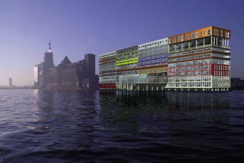
Silodam
1998 - 2002
6,750 m² industrial and retail property
350 residential property
Spaarndammerhout
2001 - 2006
950 residential property
85,000 m² industrial and retail property
Related articles:
- Cultural Identities: Almere (The Netherlands)
- Cultural Identities: Barcelona (Spain)
- Cultural Identities: Copenhagen (Denmark)
- Cultural Identities: Cosenza (Italy)
- Cultural Identities: Enschede (The Netherlands)
- Cultural Identities: Luxemburg (Luxemburg)
- Cultural Identities: Marseilles (France)
- Cultural Identities: North Rhine-Westphalia (Germany)
- Cultural Identities: "Social Town 2000" (Germany)
- Cultural Identities: Wolfsburg (Germany)


Planum
The Journal of Urbanism
ISSN 1723-0993
owned by
Istituto Nazionale di Urbanistica
published by
Planum Association